On a sunny Sunday in late October, I took my e-bike on BART from El Cerrito to the Berryessa station to explore parts of San Jose’s 63-mile trail network.
Sixty-three miles of trails? In sprawling, auto-centric San Jose?
As a long-time resident of the East Bay, I wasn’t familiar with San Jose’s ambitious, climate-friendly vision for a 100-mile, interconnected trail network, distributed equitably across the city of nearly 1 million people for recreation, getting places, and getting people out of their cars.
“The goal of our trail network is to connect people to where they want to be without the need for a car,” explained Elizabeth Sewell, San Jose’s trails manager since 2020.
As I was learning, San Jose is starting to shake off its auto-centric past. The 63-mile trail network includes three trail types: 1) multiuse core trails, 2) edge trails, which connect people with open space areas, and 3) hiking trails. In addition, the city is making its streets more friendly to bicyclists by installing hundreds of miles of bikeways, many of which are separated, or protected, from fast-moving traffic.
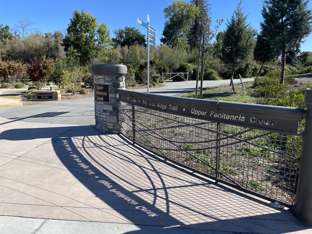
Entrance to the Penitencia Creek Trail.
Finding My Way
My first stop was Penitencia Creek Trail, which meanders northeast from the Berryessa BART station toward Alum Rock Park.
Initially, I didn’t get very far. While the trailhead was easy to find and well-marked, after a block I hit a section that was being rebuilt and I didn’t see the detour sign.
Returning to the Berryessa BART station to regroup, I was lucky to meet Tim Oey, program manager for the Silicon Valley Bicycle Coalition, who was at the station running a Smart Cycling workshop.
I asked Oey how San Jose was doing with trail and bikeway development. “Overall San Jose is doing a pretty good job on trails,” he said, especially when compared with other Bay Area cities. “San Jose has staff dedicated to trail development, which makes a big difference.”
But when I told him that I couldn’t figure out how to continue on Penitencia Creek Trail, he heartily agreed that signage can be a problem. Oey is on a Valley Transportation Authority regional committee working to improve “wayfinding” signage in all cities in Santa Clara County, which will help walkers and bicyclists to find destinations and stay on trails.
“Trail signs are missing in many places in urban areas,” he said. “I want to see good signs for walking and biking trails and destinations like we have standard signage on our streets and highways. This is a significant equity issue we need to address.”
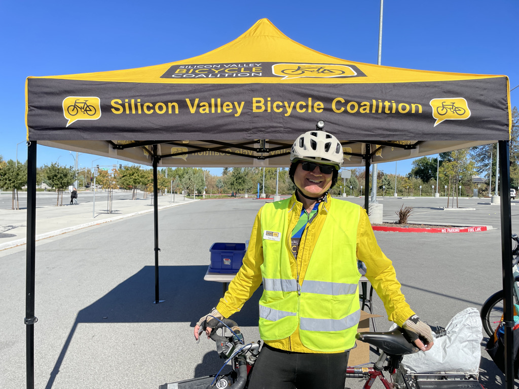
Tim Oey of Silicon Valley Bicycle Coalition.
Weekend Walkers
With Oey’s guidance, I made my way back to Penitencia Creek Trail, detouring around the trail construction, and rode several miles along the creek to Penitencia Creek (City) Park, where there was a lively community center, busy playground and picnic area, and lots of walkers out on the trail.
Leo Guiang, 47, and Liza Guiang, 49, married tech workers who live a quarter mile from the park, told me they walk Penitencia Creek trail together every other day. “The trails are beneficial for anyone who lives around here, especially the elders,” Liza Guiang said.
Farther along the trail, I found Theresa Nguyen, 32, walking her 3-year-old Dutch rabbit named Oreo. “He thinks he’s a dog,” quipped Nguyen, an art school teaching assistant who lives near Alum Rock Park. “I walk around the trails clockwise or counterclockwise. I come here if I need fresh air or a change of pace or scenery.”
On my way back I met Jimmy Oatis, 76, walking on the multiuse trail at Penitencia Creek County Park.
“For the past 4 months, I’ve been doing two or three loops around this part,” said Oatis, a retired auto parts salesperson who lives nearby. “I’m doing this for health reasons. It’s nice to walk here. Very convenient.”
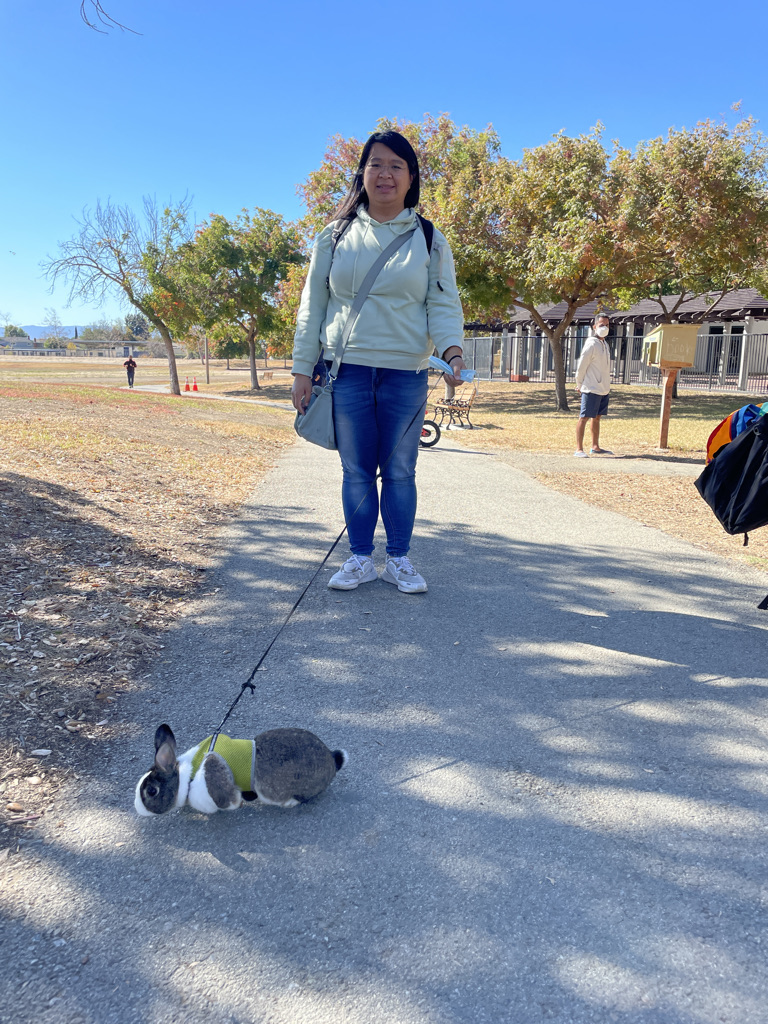
Theresa Nguyen walks her rabbit on the Penitencia Creek Trail.
Rolling on the River
Next I headed toward Guadalupe River Trail, a 12-mile multiuse trail that follows the Guadalupe River. The trail was a few miles away, and I had to ride in unprotected bike lanes next to busy traffic to get there.
My first stop was Lupe the Mammoth, a 9,600-pound, 12-foot-tall, galvanized-steel sculpture marking the site nearby where a 14,000-year-old juvenile mammoth’s tusks and partial skeleton were discovered by a passerby in 2005. Completed in 2015, the sculpture is at Trimble Road just north of the airport, adjacent to Guadalupe River Trail.
A 1:1 scale model of an adult mammoth designed by Greenmeme Studio and fabricated by Paramount Roll & Forming, Lupe the Mammoth is a super-fun reminder of the huge mammals (saber-toothed tigers! giant camels! huge sloths!) that roamed busy San Jose during the Ice Age. (A model of Lupe that includes some of the young mammoth’s bones is the centerpiece of exhibits at the Children’s Discovery Museum of San Jose.)
A lot of the Guadalupe River is in channels through the city, but I saw plenty of egrets, ducks, and other birds. The well-marked trail runs alongside the San Jose airport and through downtown San Jose.
At the southern edge of the airport I met Eric Guitierez, 28, of San Francisco, and Adan Falcon, 34, of Oakland, who drove to Mountain View, unloaded their bikes, and then rolled along San Francisco Bay Trail and Guadalupe River Trail to a free concert downtown.
“We wanted to make use of the trail to get to the concert,” Guitierez said. “It was really beautiful to see some water by the Bay,” Falcon added.
Eric Guitierez and Aldan Falcon rode from Mountain View to a concert downtown.
Shifting Trail-use Patterns
It being a Sunday, I didn’t see nearly as much activity on Guadalupe River Trail, which sees most of its activity from commuters, as I did on Penitencia Creek Trail, part of which winds through a busy neighborhood park. Before the pandemic, 30% to 50% of San Jose’s trail users were commuters, Sewell said. Now commuting has plummeted by 15% and use has shifted to multiuse trails in residential neighborhoods, according to San Jose’s 2021 annual count and survey of trail users.
“The trail network is still a valuable amenity, but the use has perhaps shifted because many people are working from home,” Sewell said. Guadalupe River Trail experienced the steepest decline, from a high of 1,200 users in one day in 2016 to about 480 last year (trail counts are conducted on weekdays).
Along with building new trails, Sewell is also focused on upgrading existing ones and creating connections at places where trails end. “Our oldest trails are showing signs of wear and tear and we need to improve them so that people can continue to enjoy them,” she said. “The City’s current priority is to work on San Jose’s core trails so there aren’t any dead ends, to enhance connectivity and activation.”
While San Jose established a goal of 100-miles of trails by 2022 in its master plan, progress has been stymied by limited funds and staff. Working for San Jose’s Parks, Recreation, and Neighborhood Services Department, Sewell is the only trail manager for the city. “It’s a 15-year process to develop a trail, and we are building them at a rate of 1 to 2 miles per year now.”
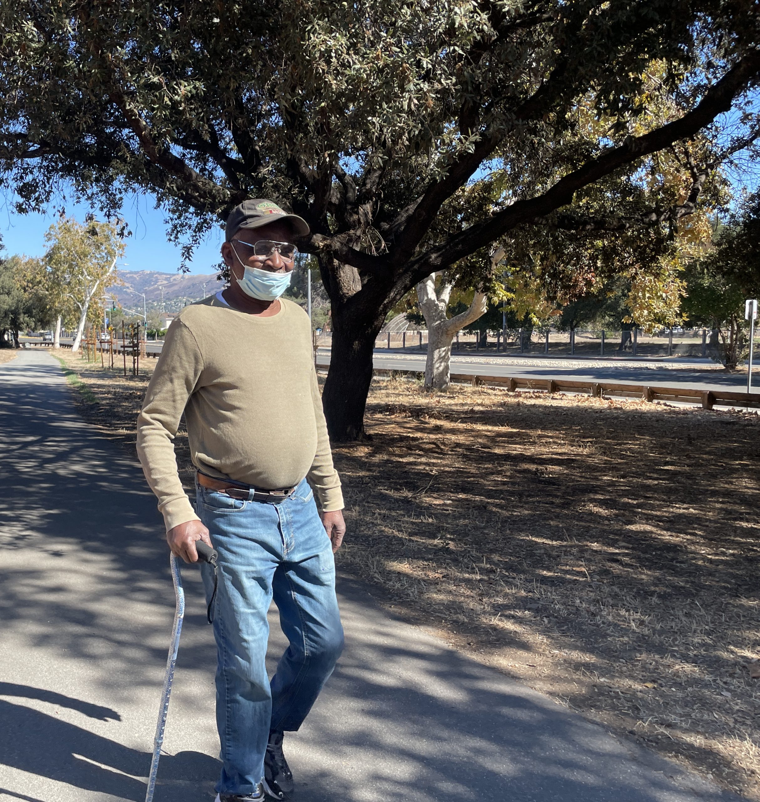
Jimmy Oatis walks for his health Penitencia Creek County Park.
Reducing Greenhouse Gas Emissions
After reaching the end of Guadalupe River Trail, I attempted to check out Three Creeks Trail, which has a new bridge. Unfortunately, I couldn’t figure out where it started, most likely due to poor signage. Somehow I ended up on the Highway 87 Bikeway, which I don’t recommend, except perhaps for commuting purposes. On the way to Berryessa BART, I rode up 10th Street on an inventive new separated bike lane (11th Street also has one).
I definitely plan to return to San Jose with my husband, Steve, to bike the Three Creeks Trail, Los Gatos Creek Trail, Los Alamitos Creek Trail, and the southern end of Coyote Creek Trail, which extends almost to Morgan Hill.
Despite some bumps in the road, San Jose is inching toward achieving its goal of 100 miles of trails, one of the city’s 10 Green Vision Goals to reduce greenhouse-gas emissions.
“Just the idea of getting people from place to place without a motorized vehicle is helping the environment and reducing vehicle miles traveled,” Sewell said. “That’s one of the reasons we’re working so hard to close the gaps — to get people to work, shopping, destinations, and points of interest using active transportation.”
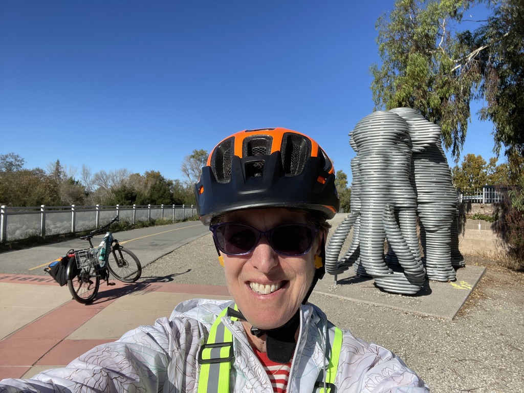
Author Janet Byron pictured with Lupe the Mammoth.
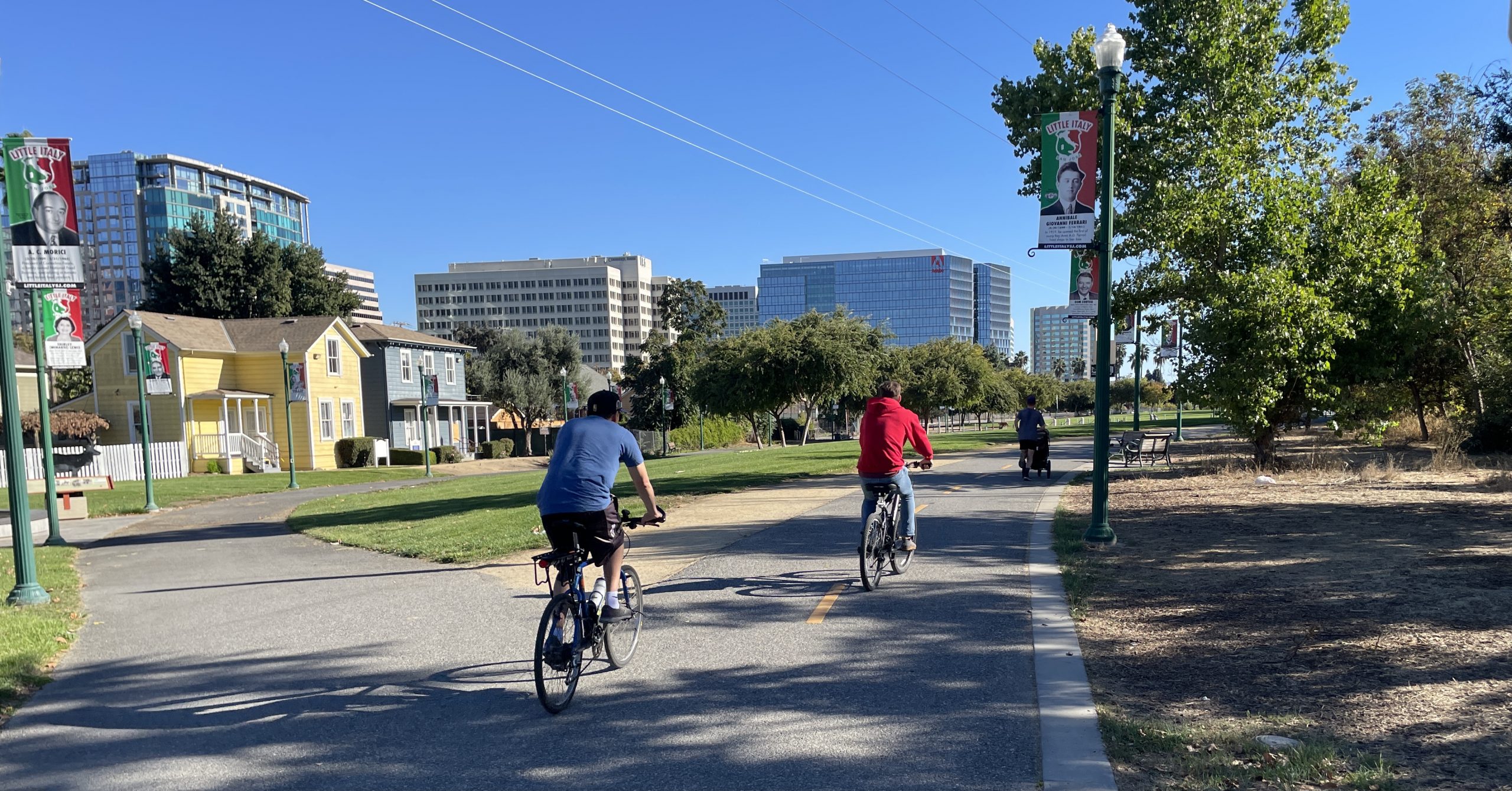
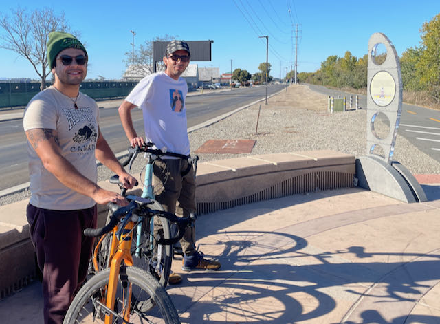
Top photo: Cyclists on the Guadalupe River Trail in downtown San Jose. All photos by Janet Byron.