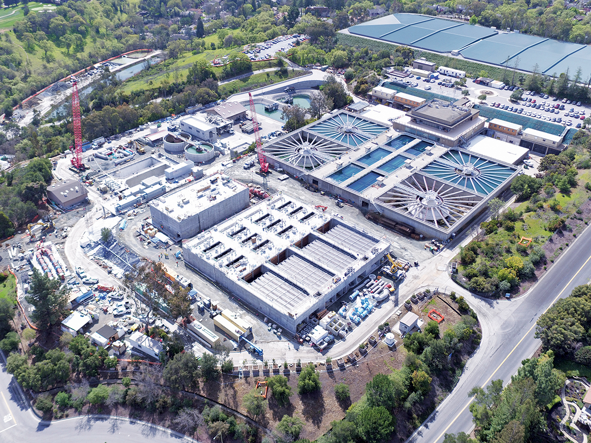
The construction team that has been working on the Santa Clara Valley Water District’s retrofit of the Rinconada Water Treatment Plant demonstrated its progress on the project by providing the agency with this photo, which was taken with a drone. Photo courtesy Santa Clara Valley Water District.
Drones may be coming to a public agency near you. The benefits are obvious: Unmanned aerial vehicles are faster and cheaper than manned flights or boots on the ground, and can also go places that are dangerous or out of reach. But drones also raise privacy concerns.
“This is a balancing question,” said Charles Belle, founder of Startup Policy Lab, a San Francisco-based nonprofit dedicated to government open data initiatives and citizen privacy. “There are strengths and weaknesses to using drones.”
Water districts make a good test case for drone use because privacy can be less of an issue. While law enforcement and emergency services are concentrated in urban areas, water infrastructure is often remote. For example, the Santa Clara Valley Water District (SCVWD) maintains 10 reservoirs for water storage, and manages about 275 miles of creeks for flood control and habitat protection.
Keeping tabs on all that is a big job, and SCVWD is developing a pilot program to use drones for surveying and mapping. The proposal is now open for public comment and will go before the district’s board in early 2019.
“We can save vast amounts of money,” said Kris Puthoff, manager of SCVWD’s Land Surveying and Mapping Unit. He estimates that the cost of taking aerial photos with a drone would be about one third that of taking them conventionally from an aircraft. District engineers use survey data to guide efforts such as repairing eroded creek banks or widening channels. The latter would cost about $10,000 per mile with a drone, compared to about $35,000 per mile with conventional methods. Drones would also be useful for flying over pipelines to check for leaks, and mapping vegetation to monitor whether non-native plants are taking over a watershed.
Besides saving money, drones save time. Besides streamlining day-to-day projects, drones would speed the water district’s response to natural disasters like flooding, earthquakes, and landslides. “Even if we have a helicopter company on standby, everyone else has them on retainer too,” Puthoff said, explaining that waiting for their turn can delay emergency response. “With drones, we’ll have our own equipment and can get out right away to survey the damage.”
Drones are also more nimble than airplanes, providing photos that surveyors couldn’t get otherwise. “You can’t see debris under a bridge from an airplane because it flies straight above,” said Andrew Chafer, an SCVWD surveyor who previously piloted drones for a private engineering company. Another key benefit of drones is worker safety.
Expanding on the example of debris caught under a bridge, Chafer explained that without drones, someone has to go down in person to take a look. “It’s not safe — water and debris are rushing underneath,” he said. “With drones, you’re not putting anyone at risk. It’s huge.”
The flexibility of drones is a red flag for privacy advocates, however. When the San Francisco Public Utilities Commission (SFPUC) launched a pilot drone program in 2017, “privacy concerns were paramount to the rollout,” said Josh Gale, who works in Emergency Planning and Security at SFPUC. The primary concern is personally identifiable information: “You have to scrub the data to block any faces or license plates.”
So far, personally identifiable information hasn’t been a big issue for the SFPUC. The dozen drone flights they’ve done to date have been in remote watersheds in San Mateo County and the East Bay, focusing on environmental monitoring and infrastructure inspection. “We’re in the very beginning stages of using this technology in our world and the benefits are huge,” Gale said. “We’re lucky that our uses don’t face the same privacy concerns as those by the fire department, which is primarily urban.”
Beginning with non-emergency services can help win buy-in from privacy advocates, said Startup Policy Lab’s Belle. “I agree with the benefits but privacy risks are real,” he said. For example, drones can have unintended consequences that trip up non-emergency agencies, such as picking up collateral information from bordering properties with illegal activity. “All of a sudden you’re sharing data with law enforcement,” he said, adding that many local police departments share information with the Federal Bureau of Investigations.
The Federal Aviation Administration projects “phenomenal growth” in the number of commercial drones nationwide over the next few years, estimating that they will quadruple from about 110,000 in 2017 to about 450,000 in 2022. The Electronic Frontier Foundation (EFF), a San Francisco-based nonprofit dedicated to digital privacy, states that “the technology that can be equipped to a drone is disconcerting, as they are capable of highly advanced and near-constant surveillance.”
This technology includes live-feed video cameras, thermal infrared video cameras, heat sensors, and radar — as well as cell-phone interception, license plate readers, face recognition, and GPS trackers. “Privacy law has not kept up with the rapid pace of drone technology,” according to the EFF. However, some cities, including San Francisco, do have policies that limit municipal drone use.
Belle helped set the San Francisco drone policy as a member of the city’s Committee on Information Technology. Developing the policy took two years, and Belle draws several lessons from the process. One is that flight paths should be publicly accessible. Knowing when and where drones flew lets people check to make sure that agencies are sticking to their allowed uses, lessening privacy concerns.
In addition, data management should be transparent. “This is the big one where it gets really intense,” Belle said. “Where is the data going?” Considerations include exactly what information is collected, where it is collected, who stores it and for how long, and — perhaps most importantly — who can access it. Data could be held on an agency server or on a state server, for example, and the latter could have a policy of sharing information with the federal government.
A final lesson is the importance of a defined timeline for drone pilot programs. “The pilot program lets you run use cases,” he said. “Then you need an end point so you can assess the program — and refine the policy.”
Robin Meadows covers water for the Monitor.