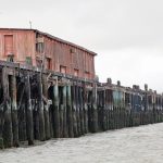
Highway 37 is subject to increasing flooding as sea levels rise. Photo by Alec MacDonald.
Driving delays have long been a major source of stress for many Bay Area workers and travelers — so they’ll be unhappy to learn that rising sea levels imperil the region’s road network, threatening to cause even greater delays with episodic shoreline flooding.
Along U.S. Highway 101 in Marin County there are several flood-prone spots, including Marin City, whose topography acts like a bowl. Further north, State Route 37, a 21-mile connector linking job markets and housing within Marin, Sonoma, Napa, and Solano counties, has a history of frequent flooding. And in the South Bay, the low-lying western approach to the Dumbarton Bridge in East Palo Alto is prone to deluges that can stall movement of its nearby working-class community.
The impacts of climate change, including sea-level rise and extreme weather, will contribute to more frequent and severe coastal flooding that affects individual residents. More than five million daily vehicle trips around the region would need to be rerouted due to flooding when total water levels (a combination of tides, surge, and wave runup) reach four feet, according to the San Francisco Bay Conservation and Development Commission’s (BCDC) Adapting to Rising Tides March 2020 report.
New Stanford University research takes it a level further and pinpoints areas where coastal flooding events could delay commuters over the next 20 years, based on analysis of private vehicle traffic during peak morning travel at varying water levels. It reinforces the idea that regional coordination is key to bolster road network defenses and ensure protective steps taken in one community don’t negatively affect bay conditions elsewhere.
“Sea-level rise is a regional problem and not just a coastal problem,” said Indraneel Kasmalkar, an engineering PhD candidate at Stanford and lead author of the study. “Even far from the shoreline in Santa Rosa you might still be affected because the road network is connected.”
The reminder comes as COVID-19 drives new opportunities for policymakers to reimagine regional transportation. They are considering measures such as telecommuting and reducing car-produced emissions, and, in this case, what investments are necessary to make sure access and economic activity aren’t compromised because of flooding.
Traffic plunged after shelter-in-place orders were issued on March 19, but it’s piling up gradually. For example, average daily traffic counts on SR 37 at Harbor Drive were 30,900 in August. That’s up from 19,800 between March 14 and 31, according to data from the Caltrans Performance Measurement System.
“There needs to be oversight to plan ahead for those kinds of [flooding] events rather than reacting after they happen,” said Brian Gilardi, who relies on SR 37 to travel between his oat hay farms located near the Petaluma River’s southwestern end, as well as behind the Bel Marin Keys community in Marin.
Some Bay Area cities and counties had begun their own sea-level rise assessments and were coordinating with other groups and jurisdictions before the coronavirus appeared. By taking a region-wide view, the Stanford report reinforces the importance of such coordination, pointing out indirect consequences of broken transportation networks.
“It’s not really how exposed you are to the flooding, but whether you have sufficient alternate route capacity to offset increases in traffic or route closures,” Kasmalkar said.
Stanford’s model is built upon road network, census, and traffic data from 2010 through 2020 in conjunction with regional flood maps produced by BCDC. The research team defines coastal flooding events as extreme water levels resulting from potential combinations of storm surges, tides, seasonal cycles, inter-annual anomalies driven by climate variability such as El Niño, and sea-level rise.
Kasmalkar and his colleagues determined parts of Marin County, which is surrounded by water on three sides, would experience traffic delays of 30 minutes or more in the event of a one-foot flood. That’s mainly due to the sparsity of the county’s road network.
“If one corridor goes down, the other corridors are highly stressed as a result,” said Nick Nguyen, project manager and engineer at the Transportation Authority of Marin (TAM).
A SR 37 closure, for example, would snarl traffic on surrounding highways and sub-corridors, according to pre-COVID-19 traffic data from TAM. State Route 121, an alternate two-lane northern route, would see traffic increase by 47 percent, while the Richmond-San Rafael Bridge, a southern route alternative, would experience a nearly 60 percent traffic increase.
Like Marin, San Mateo County also has high flood exposure. However, it will see shorter commute disruptions because of its “advanced through-network with alternative routes” between work and home, Kasmalkar said. His study projected that a three-foot flood would create an average delay of 0.02 minutes per mile in San Mateo County, compared with 1.2 minutes per mile in Marin.
Kasmalkar said what surprised him and his team most is that commute impacts aren’t isolated to a given flooded area. For example, 20 to 50 percent of Santa Rosa residents — living more than 20 miles from the bay shoreline — would face commute delays of 30 minutes or more in the event of a one-foot flood. But only 5 percent of people living on the Peninsula in Santa Clara and San Mateo counties would face similar delays, even from a three-foot flood. They have multiple corridor choices, not all of which are exposed to flooding.
These findings have big implications for sea-level rise adaptation planning, which requires both land-use and transportation decisions that affect multiple stakeholders. BCDC launched its Bay Adapt initiative earlier this year to coordinate the efforts.
Bay Adapt is currently working on a “joint platform,” or a shared set of 10 to 15 actions for regional sea-level rise adaptation. A draft of the platform is forthcoming, according to BCDC’s Dana Brechwald. She said the next goal is figuring out how to implement these actions, work together to secure funding, set up new databases, and promote new legislation.
BCDC also is collaborating with the Metropolitan Transportation Commission to align approaches with MTC’s forthcoming Plan Bay Area (PBA) 2050, a long-term planning roadmap outlining a vision for growth and infrastructure.
The PBA 2050 draft blueprint was shared with residents this summer. It contains strategies and a set of investments for implementation over the next 30 years. One strategy includes “Adapt to Sea-Level Rise” with possible solutions like elevated roadways, marsh restoration, and tidal gates to protect shoreline areas in parts of the Bay Area.
But none of this is cheap. MTC’s sea-level rise assessments compare the anticipated fiscal need over the next three decades against available forecasted revenue. It’s identified $11 billion in existing revenue sources that, when combined with $8 billion in potential new revenues (such as adding to the regional parcel tax, expanding assessment districts, enacting new business taxes, or receiving more state and federal funding), would provide an estimated $19 billion to meet sea-level rise funding needs for two feet of sea-level rise by 2050.
Some resilience investments are unique because they propose fixes in areas that cross PBA’s adaptation and transportation planning lines. For example, SR 37 sits in the San Pablo Baylands, an important habitat for protected species. It has been closed for weeks at a time, most recently in 2017 and 2019, due to flooding.
A SR 37 policy committee representing Marin, Napa, Sonoma, and Solano counties, as well as MTC and Caltrans, was formed in 2015 to plan for congestion relief and sea-level rise projection. The work has advanced to various stages of environmental review.
Overall, sea-level rise work “requires not just the government paying attention, but the public paying attention,” said Chris Choo, principal watershed planner for the County of Marin. “We need engagement and for folks to get involved and be solutions-oriented.”
Bay Adapt will host a public forum to discuss its joint platform this fall.
Cecily O’Connor covers transportation for the Monitor.