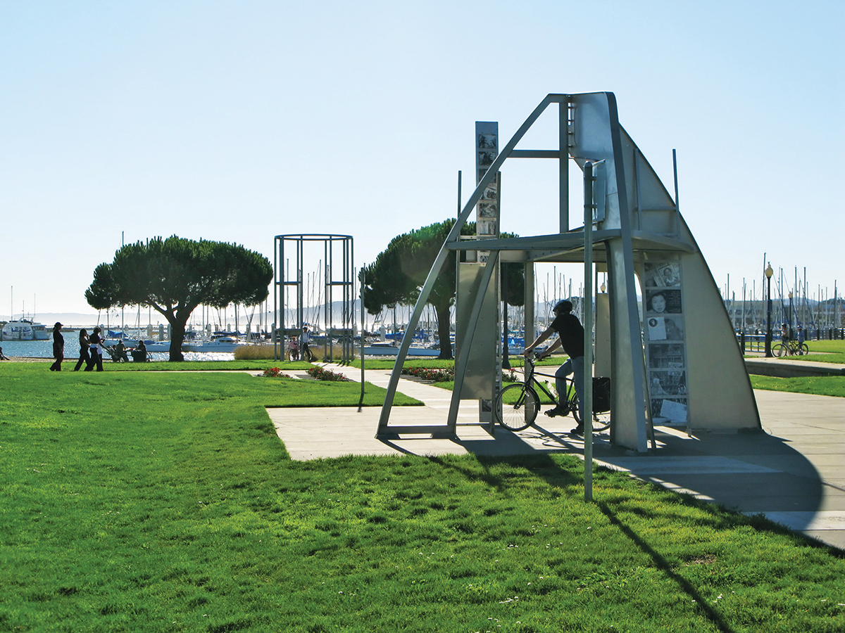
The San Francisco Bay Trail runs by the Rosie the Riveter Memorial in Richmond’s Marina Park. Photo courtesy Wikimedia Commons.
Most trails in the Bay Area have stories to tell, with histories that deepen our experience of the land we walk on. The trails that effectively communicate and interpret history offer the best opportunity for users to experience a layered trail. One of the best examples winds through the Rosie the Riveter World War II Home Front National Historical Park in Richmond, where the San Francisco Bay Trail is further animated by interpretive signs, a memorial, a website with historical content, and a smartphone audio tour. Although currently not an option due to the pandemic, history can also be gleaned at the museum, on tours with docents, or on a Victory ship.
It’s a challenge to convey the history of a place to all users of trails, be they history buffs or those out for fresh air and exercise. Here are three examples of organizations currently brainstorming and developing ways to tackle that challenge.
Construction will begin this year on a new 2.5-mile section of the San Francisco Bay Trail from the eastern foot of the Richmond-San Rafael Bridge up to Point Molate. Once the trail is open to the public, it will be a prime example of a trail animated by cultural history. Imagine that you are walking on that new trail with the past layered beneath your feet. The deepest layer is the Ohlone and Miwok people who lived on the land for thousands of years. Above that layer is the Spanish Colonial Era and Rancho San Pablo.
Hovering over that is the Gold Rush, and then a thriving Chinese shrimp camp where Point Molate Beach Park is today. The Winehaven Historical District is a layer atop that, followed by a World War II Navy Fuel Depot. The most recent layer is the San Francisco Bay Trail itself, which tells the story of activists working to provide shoreline access to all. Fifty years ago, the public had access to only 65 feet of Richmond’s shoreline, but with the completion of this trail there will be 20 miles of public access.
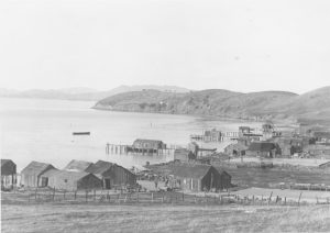
The Point Molate Chinese shrimp camp in Richmond circa 1870 – 1912. Photo courtesy Richmond Museum of History.
You can learn about the history of Richmond and its shoreline by going online, visiting the Richmond Museum of History (when it opens again), or by reading books such as Donald Bastin’s Richmond. When the trail opens, it will have interpretive signs designed and installed by the East Bay Regional Park District in collaboration with the City of Richmond and the Trails for Richmond Action Committee (TRAC). “With 32 miles of shoreline, Richmond’s history is on the shore,” said Bruce Beyaert, chair of TRAC, the nonprofit helping to open the trail. “In collaboration with others we have designed, produced, and installed about 50 interpretive and wayfinding signs on the Bay Trail in Richmond.”
One of the challenges of interpreting history is that, unlike the crystallized minerals in geologic layers, histories shift over time. “The history taught to people is often reflective of the time period in which those histories are told,” said Martin Rizzo, historian for the Santa Cruz District of the California Department of Parks and Recreation.
Take for example the history of fire in Big Basin Redwood State Park in the Santa Cruz Mountains. The park is closed indefinitely due to last summer’s CZU Lightning Complex Fire that burned through 90 percent of the park’s 18,224 acres and destroyed most of its structures, including those built by the Civilian Conservation Corps in 1936. While the destruction and closure are devastating, they also provide an opportunity to re-examine the interpretation of fire.
“Big Basin was born of fire, and redwoods are the stars of that story because they have evolved over the centuries to respond to fire as part of their world,” said Julie Sidel, a park interpreter with the state parks department. A fire in 1899 led to the formation of the Sempervirens Fund and the founding of Big Basin, California’s first state park. In 1904, the year the park opened, three fires burned at once, prompting a local newspaper to report a scene that we can relate to today: “a heavy pall of dense smoke settled down on our town, the sun a glaring disk of fire in the heavens but with its rays so intercepted by the smoke that it hardly casts a shadow.”
Fire has been a consistent theme in the park’s storytelling. Sidel and other docents referred to fire-damaged trees on the Redwood Loop Trail to discuss the natural history of the park, including the 1904 fires. But fire and its relationship to the land goes much deeper than the turn of the 19th century, and staff at the state park want to deepen its igneous storytelling. For at least 13,000 years, indigenous people used fire to manage resources and control large fires. The village site for the Quiroste tribe that lived in the Big Basin area was Achistaca. “This tribe was the largest and most powerful of the local Ohlone tribes, and their homelands stretched from Año Nuevo up into the redwoods of Big Basin,” said Rizzo, who specializes in Santa Cruz, Monterey Bay, and San Francisco Bay Area native peoples.
During the Spanish Colonial Era, the missionaries forbade the tribes from setting controlled fires, leaving unwanted fuel on the ground that has accumulated for centuries. In recent years, the state parks department has been working with the Amah Mutsun Tribal Band and other tribes to learn the indigenous techniques of prescribed fires. The Amah Mutsun and Muwekma Ohlone tribes claim the Quiroste as ancestral relatives, said Rizzo.
“The sunny side of the recent fires is the opportunity to tell these histories in new ways that reflect our values today, with a more inclusive understanding that recognizes the contributions of native peoples in particular,” said Rizzo.
The interpretation of fire has already changed over the last few decades; whereas Smokey Bear’s message focused only on fire suppression, the message today is more complex. “We still don’t want people to go out there and start fires,” Sidel said, “but we also want to convey a deeper understanding of the role of fire in land management in the history of California and the West, and to use science and history as a way to bring the concept of prescribed fire into broader acceptance.”
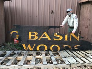
Mark Hylkema of the California Department of Parks and Recreation holds a fire-damaged sign from Big Basin State Park. Photo by Martin Rizzo.
How they get that message across to people walking the trails once Big Basin opens is part of their challenge. One thing is certain: fire-scarred trees will help to illustrate the message. “Maybe we can help people accept fire management, and accept that fire-scarred trees are part of the natural world that we love,” said Sidel.
Further north in Solano County, Solano Land Trust is developing the stories that they want to tell on the trails of a new 1,500-acre open space park (currently open only for docent-led tours). “This is the first property that I’ve worked on where we’ve had a comprehensive communication strategy,” said director Nicole Braddock. “We’re working on the signs that we want on the property, the stories we want to tell, and the different themes we want to hit.” The themes include wildlife, ranching, cultural history, and fire, and the planning committee has found that the ways of the indigenous people cross all of the themes.
To help tell stories on the trails (that are not yet officially named), Solano Land Trust is collaborating with the Yocha Dehe Wintun Nation, which provided a name for the new park. The official name of the park is Patwino Worrtla Kodoi Dihi, which means Southern Rock Home of the Patwin People. “We want to honor the Patwin people by starting with renaming the property, and continuing with a partnership to tell stories of the land,” said Braddock. “Through the signage, and maybe through some of the trail names, we want people to come away knowing a handful of Patwin words. It’s really important to the Patwin people that they don’t lose their language.”
As these organizations ready their properties for public use and brainstorm ways to effectively create layered trails of history, you can engage with the concept by reading interpretive signs on trails at the Marin Headlands or in the Presidio of San Francisco, or by taking any number of audio tours on the San Francisco Bay Trail.
Once you’re on a trail, picture the layers of history below your feet, and with your imagination set the layers in motion. That is an animated trail of history, and you are part of it.
Aleta George covers open space for the Monitor.