Transportation writer Cecily O’Connor’s latest Monitor article focuses on bicycle safety and mobility in the nine-county Bay Area. She reported on efforts by Caltrans District 4 to develop a bicycle plan, which residents can help shape in various ways, including through an interactive online survey.
This survey holds intriguing potential as a public engagement tool, representing an opportunity for civic participation in government planning that the Monitor, as a publication of the League of Women Voters, has reason to consider. So, using the survey and other online resources, we’ve put together the following bicycle network photo tour to raise people’s awareness and encourage them to get involved in Caltrans’ planning process.
On Thursday, March 23, Monitor editor Alec MacDonald took his camera and mountain bike on a 50-mile, 9-hour excursion on, across, and beside state roads in four Bay Area counties. In addition to exploring the bicycle network, this photo tour also showcases articles in the April/May Monitor, as all the topics our writers covered in the new edition are coincidentally illustrated along the route. We’ve even thrown in links to a few older articles as well.
So, strap on your helmets, and let’s get started. To expand any photo, just click on it.
Our tour begins in Berkeley at the intersection of Ashby Avenue (State Route 13) and San Pablo Avenue (State Route 123). Ashby starts at the Bay’s edge, heading up from an Eastshore Freeway exit below Aquatic Park toward the Claremont Hotel, where it turns into Tunnel Road before crossing State Route 24 in the Oakland Hills. San Pablo originates from Downtown Oakland, running north in a rough parallel with the Eastshore Freeway to the west and the Richmond BART line to the east. The map below is a screenshot from the Caltrans online survey, which highlights state routes with bluish-purple lines. The blue bike pin in this screenshot represents where the accompanying photo was taken, and is one of the survey’s interactive features that allows for detailed user feedback on specific locations.
![]()
![]()
Northbound San Pablo is not a particularly scenic ride, but there are a fair amount of shops, restaurants, and businesses along the way. Two lanes run in both directions with a divider in the middle; there are no bike lanes. Spacing doesn’t feel dangerously tight, but AC Transit operates frequent 72 line service that bicyclists must jockey with. They may feel more comfortable accessing Berkeley’s Bicycle Boulevard Network, which has a parallel route along Ninth Street. The network is promoted with purple signage (below left) and features painted “sharrows” (below right, along Virginia Street).
![]()
![]()
In Albany, Buchanan Street connects San Pablo with the Eastshore Freeway at the I-580/I-80 split. Bicyclists can traverse these thoroughfares with relative ease thanks to a special looping path.
![]()
![]()
![]()
![]()
Maintenance workers were busy attending to vegetation alongside the Buchanan interchange with trimmers, which — as Leslie Stewart revealed in her latest Monitor article about small off-road engines — are a surprisingly significant source of air pollution.

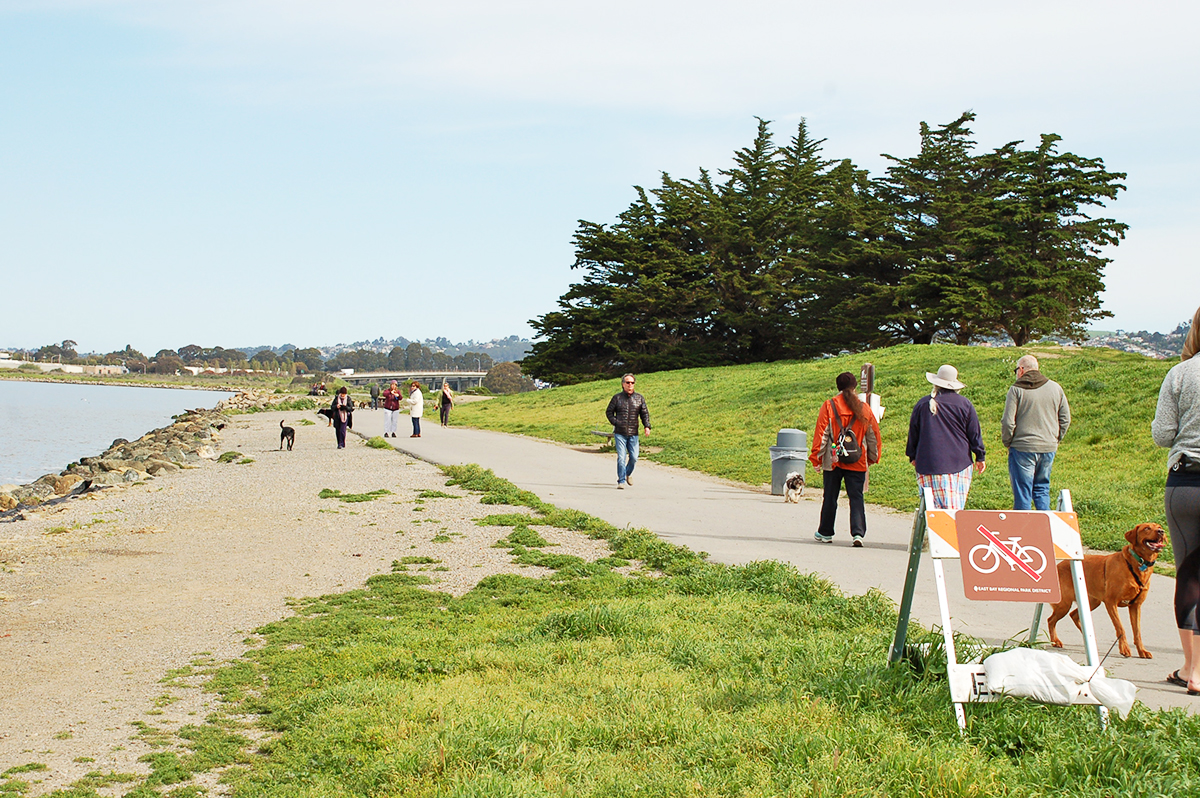
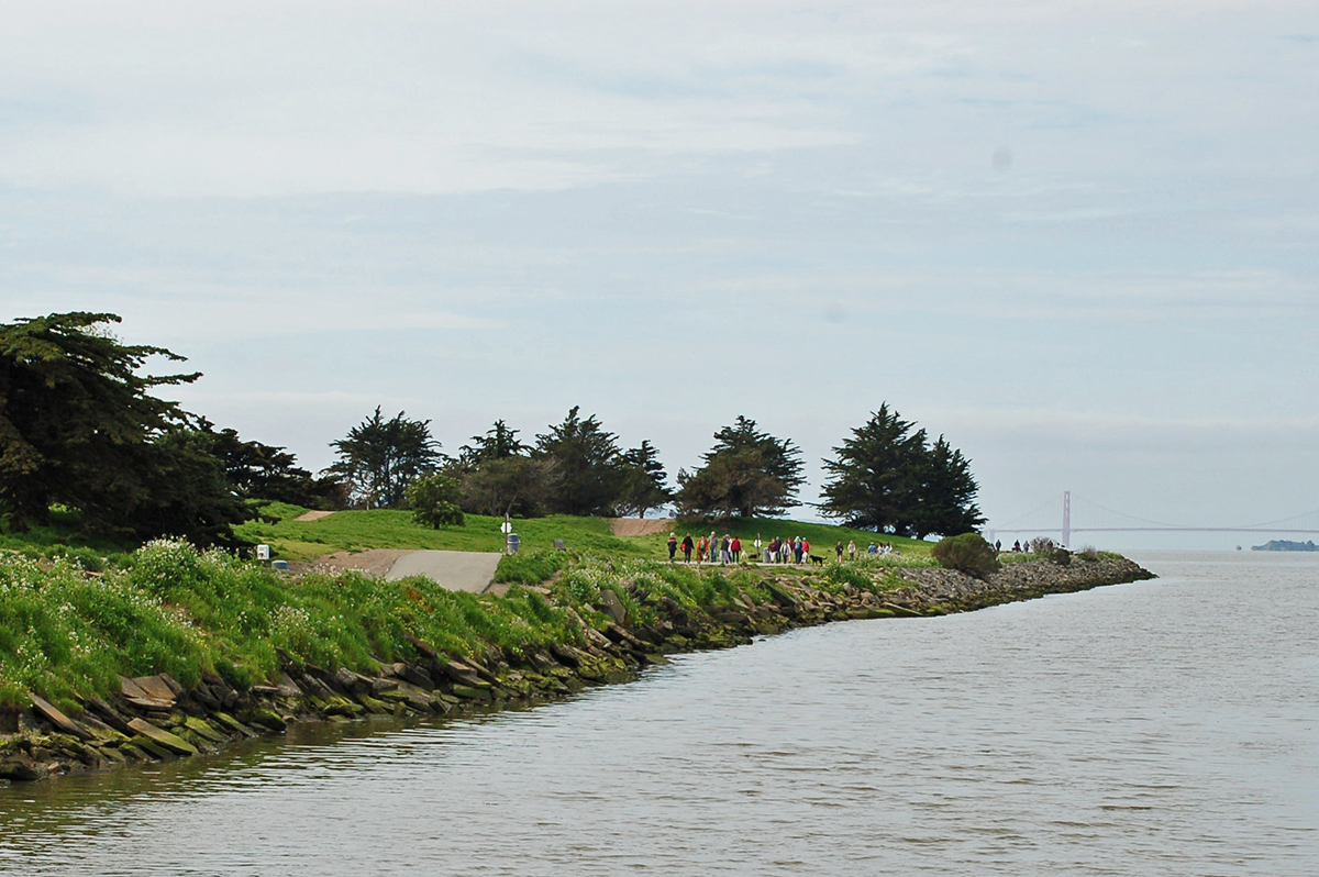
On the west side of the freeways, Buchanan Street joins the San Francisco Bay Trail out to the Albany Bulb. Bicyclists can also take the trail north along the shoreline, bending under the arc of I-580 toward the East Bay Regional Park District’s Point Isabel. It’s a popular destination for dogs, who are free to roam where bikes cannot (below left). The morning haze somewhat obscured a pleasant view of the Golden Gate Bridge.
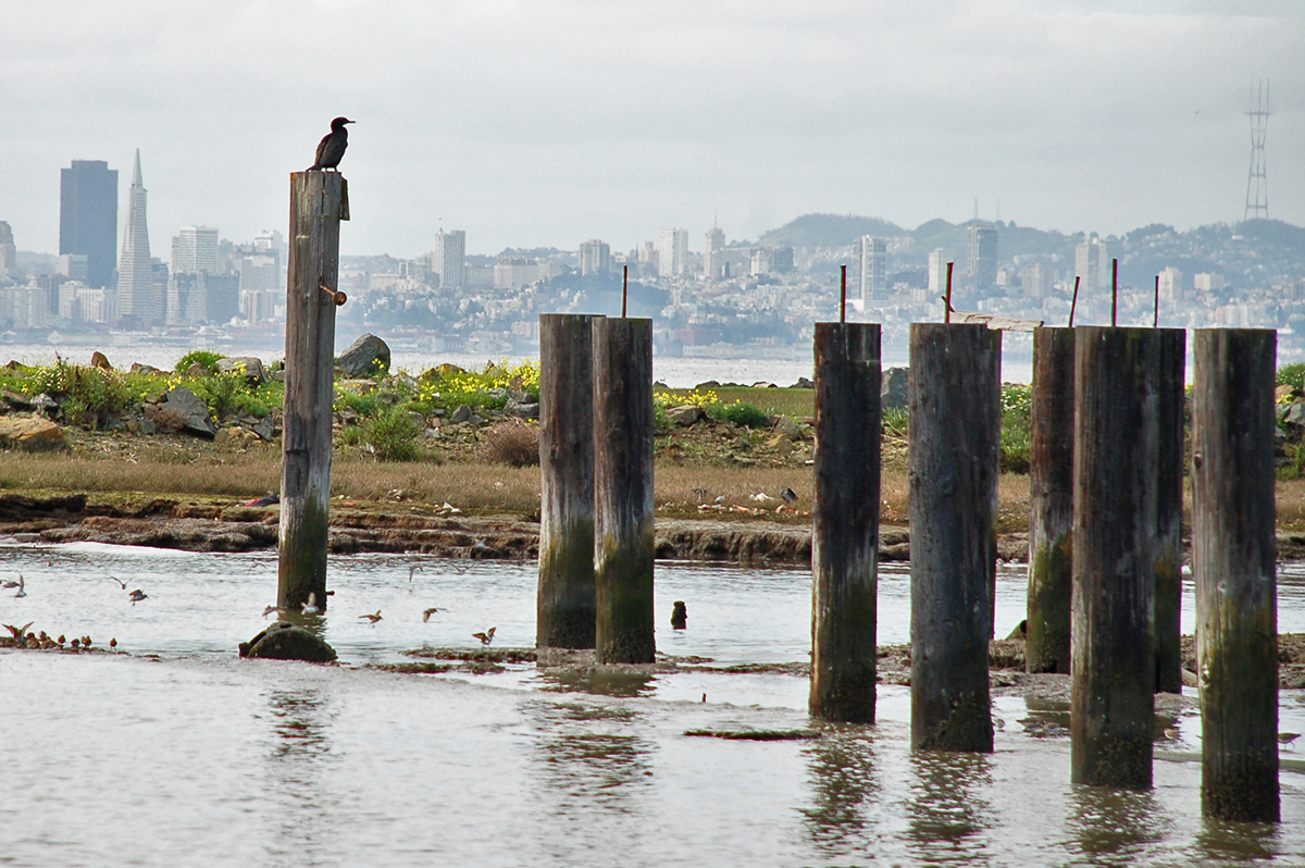
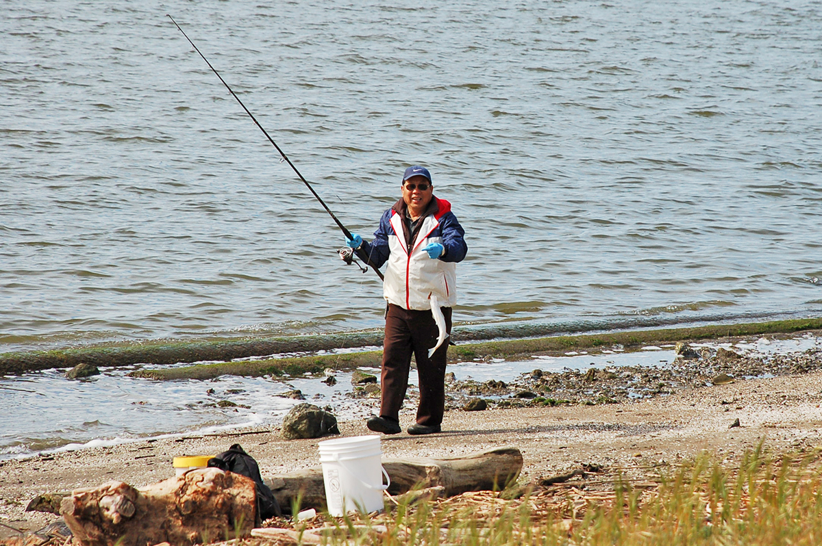
Picturesque wooden pilings add to the shoreline tableau, but as Robin Meadows explained in her latest Monitor article, these have a major downside — they have been treated with a toxic substance called creosote. This legacy pollutant is harmful to herring, and the State Coastal Conservancy has taken steps to address the situation.
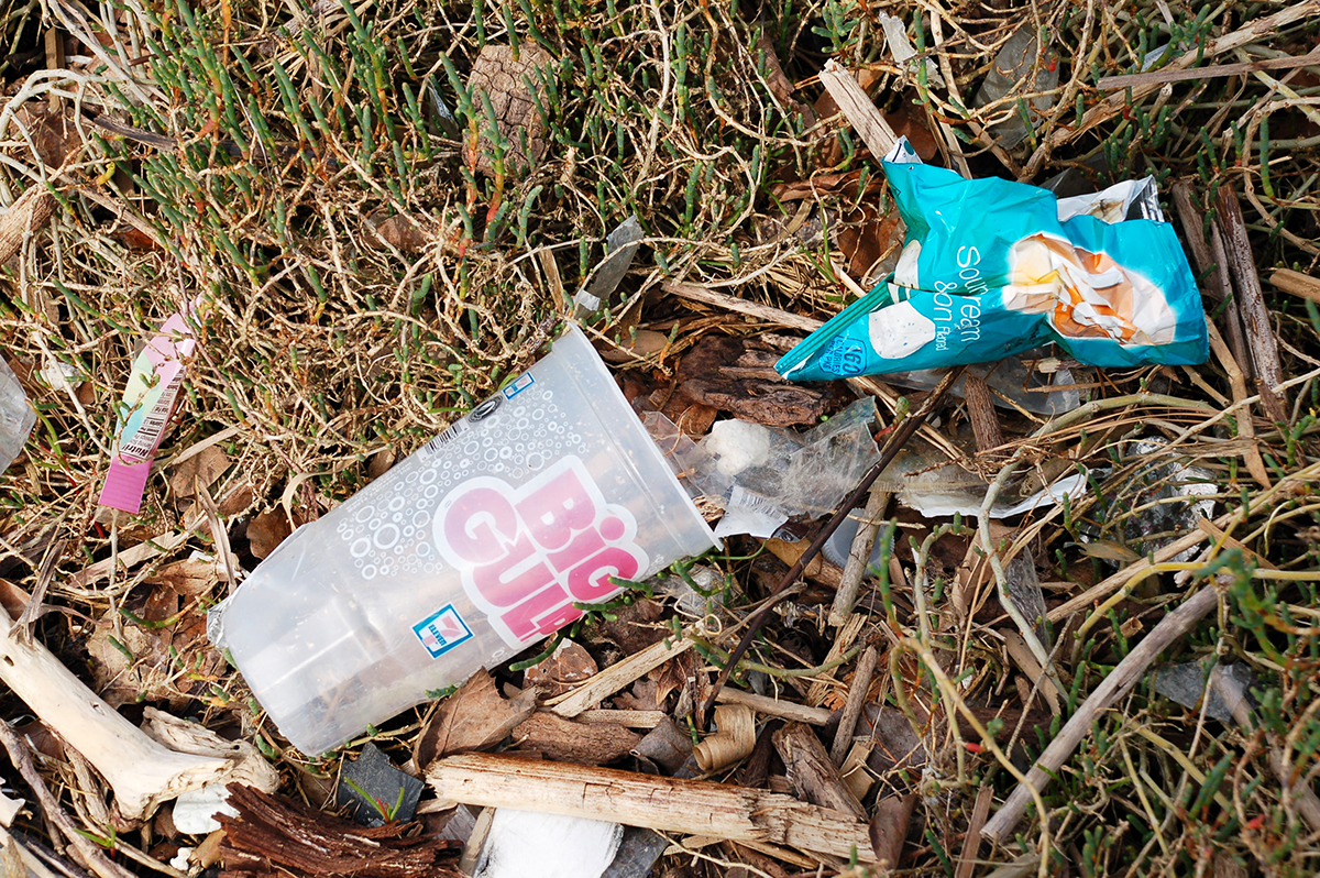
Another topic that Robin has covered for the Monitor was unfortunately visible in the same spot. As she wrote in the April/May 2016 edition, trash continues to be a huge problem for local waterways and the overall health of the Bay. The angler who reeled in a striped bass nearby would likely prefer his catch not have been swimming through such mess.
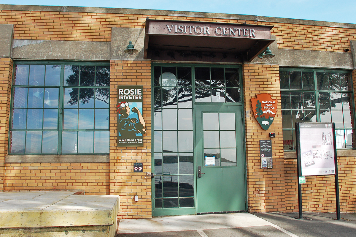
The Bay Trail continues along the Richmond shoreline, passing by the front door of the Rosie the Riveter WWII Home Front National Historical Park, a repository of incredible stories preserved by the century-old National Park Service — a trove that Monitor open space writer Aleta George dug into for the August/September 2016 edition.
After passing by the Rosie the Riveter facility and adjacent Craneway Pavilion, the Bay Trail jogs up Harbor Way South before bouncing off I-580 a couple times. Cutting Boulevard offers a bike lane to pick up the trail westward, as in the photo below, taken from the vantage of the blue bike pin on the accompanying map.
![]()
![]()
Cutting Boulevard provides access to a Bay Trail loop around Point Richmond, and is also the primary East Bay stretch for Golden Gate Transit‘s 40 line bus. Originating from the El Cerrito Del Norte BART Station, the 40 line is currently the only way to get a bike across the Richmond-San Rafael Bridge, at least until completion of a path project that is in the works. The 40 line’s last stop in Contra Costa County is at Tewksbury Avenue and Castro Street below the I-580 approach to the bridge.
![]()
![]()
On the Marin County side, the 40 line ends at the San Rafael Transit Center (below left), a hub serviced by five bus operators connecting some two dozen lines. Across the street stands the southern terminus (below right) for Sonoma-Marin Area Rail Transit, whose trains will start running in a matter of months, providing access to the Sonoma County Airport and points in between. The rail system is planned to eventually extend down to Larkspur, near the ferry terminal. Extending the rail system will necessitate relocating the bus hub, which appears a complex proposition, especially when factoring in the presence of US 101. How planners will accommodate bikes within this mix also represents a tricky question. As things currently stand, bicyclists can jump on Bike Route 5 via Francisco Boulevard West (bottom left), doubling back down alongside the highway (bottom right).
![]()
![]()
![]()
![]()
After the junction with I-580, Route 5 is full of impressive infrastructure features that keep a southbound rider within close proximity of US 101.
![]()
![]()
![]()
![]()
A planned stop on the tour was Clean Air Lawn Care in Mill Valley, since Leslie had interviewed proprietor Mill Nash about using minimally-polluting landscaping equipment. A few photos of snazzy electric lawnmowers would have illustrated her article nicely, but that was not meant to be. As handy as Google Maps was in helping plot a tour course, it provided an incorrect address for the landscaping business, mistaking it for what in reality is a dry cleaner. Air pollution happens to be an issue for that industry as well, however, so perhaps Leslie has her next lead…

Across East Blithedale Avenue from the misidentified storefront, a paved path (shown in the photo below, which was taken from the vantage of the blue bike pin on the map) leads to where the Bay Trail wraps the top of Pickleweed Inlet in Richardson Bay. The trail can be followed two ways: east toward Tiburon or south toward San Francisco. The latter choice soon cuts under US 101 and hugs the water down to the Sausalito Ferry Terminal.
![]()
![]()
After entering the Marin Headlands, bicyclists bound for the Golden Gate Bridge can take the proverbial and literal scenic route of East Road, or be more direct with Alexander Avenue. Saving time comes at a sacrifice, however, as the shoulder does not provide much comfort (below left). Alexander Avenue soon meets up with US 101 (as in the map, and photo at bottom left), and then it’s a quick pedal on a much wider shoulder (bottom right photo) to the north end of the bridge.
![]()
![]()
![]()
![]()
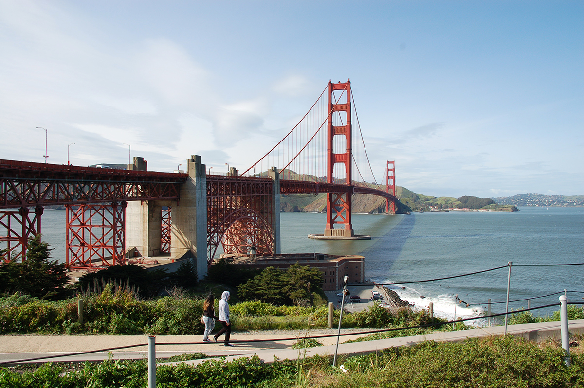
Traversing the bridge itself is a breathtaking experience. As one might generally expect.
![]()
![]()
![]()
![]()
And… welcome to San Francisco.
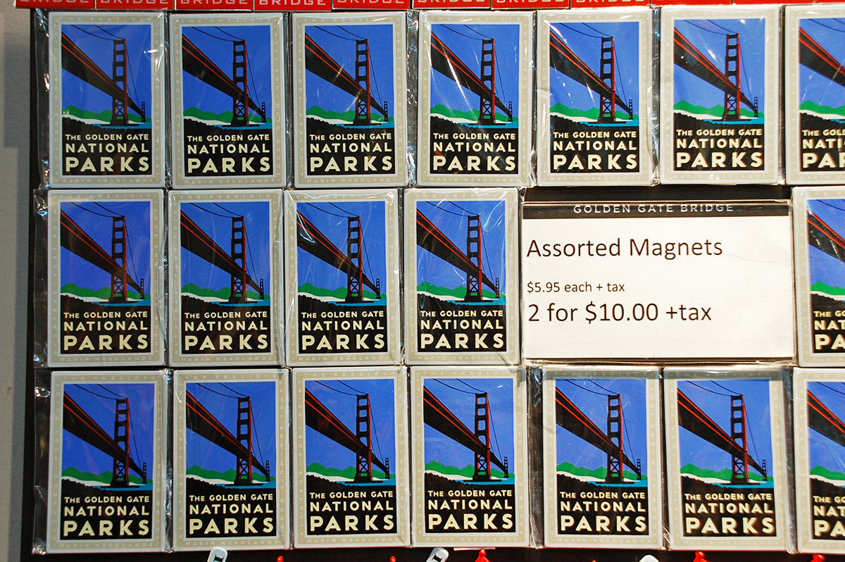
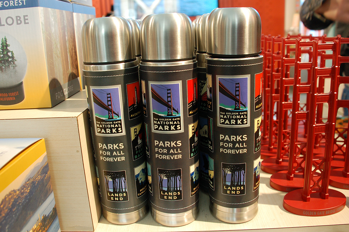
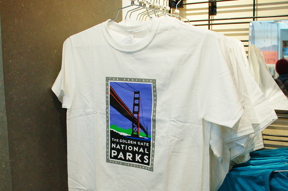
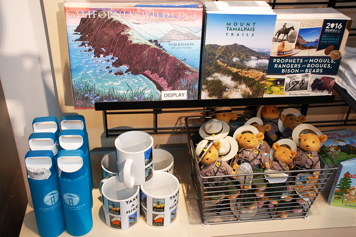
Bridge visitors can drop in at the Golden Gate Pavilion to get information and view exhibits, as well as pick up a memento or two. As Aleta served reminder in her latest Monitor article, such keepsakes preserve the memory of a visit and help fund the preservation and maintenance of iconic destinations. In examining the role of art in supporting open space, she spoke with artist Michael Schwab, who designed promotional posters for the Golden Gate National Parks Conservancy, and Robert Lieber, the nonprofit’s Vice President of Interpretive Sales; the fruits of their collective labor are available for purchase at the pavilion, including magnets, thermoses, t-shirts, and mugs. A book of prints by artist Tom Killion, who Aleta also interviewed, was on display as well (bottom right).
The open spaces of the Presidio, Crissy Field, Baker Beach and the surroundings offer ample options for bicycling, although it is prohibited on the area’s two state routes, US 101 and Veterans Boulevard. Crissy Field Promenade (where both bottom photos were taken) doubles as part of the Bay Trail, and provides a scenic route along the shoreline.
![]()
![]()
![]()
![]()
Bicycling becomes decidedly less friendly in the transition from the Golden Gate National Recreation Area into the neighboring Marina District. Bikes are allowed on the US 101 stretches of Lombard Street and Van Ness Avenue, but they aren’t particularly welcome. Space is especially tight along Lombard (below left), and Van Ness is currently under construction toward the implementation of San Francisco’s first full-featured Bus Rapid Transit project. Parallel routes with bike lanes or other accommodations may run close by, but if so, there’s no signage posted to indicate their presence. A bicyclist who finally reaches city hall (bottom right) intact can breathe a sigh of relief.
![]()
![]()
![]()
![]()
From there, the trip back to the East Bay is a simple matter of hopping on BART at Civic Center. After an eight-station ride on the Richmond line, our tour ends at the Ashby BART station, home of the Ed Roberts Campus along the developing Adeline corridor. We end just a mile up State Route 13 from where we started.
![]()
![]()
![]()
![]()
So that’s all, readers. Please bike safe, engage in the Caltrans District 4 process if you feel so moved, and dig into the April/May edition of the Monitor.
.